Ken curates
TyneLine
泰恩線
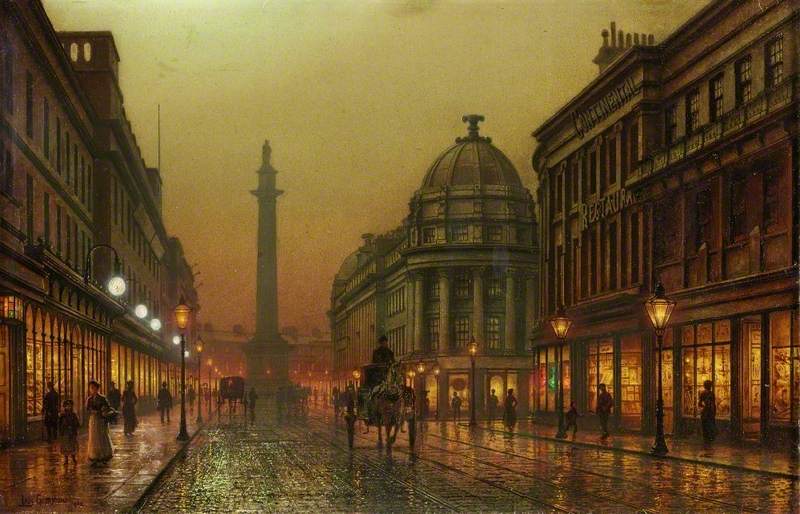
This painting in the Laing Gallery caught my eye when I was passing through the Northern Spirit Gallery. It’s such a nostalgic picture, with its lighting, structure, and sense of feeling.
This painting of Grainger Street is so familiar and inviting to me; I find myself travelling in time. It is part of my daily life walking past Grey’s Monument on the way to the Grainger Market and Central train station. Suddenly, I understand why I have chosen this city as my home now.
It also inspired me to think about the development of North East England: the industrial development, the engineering, the architecture, the inventions, and improvements in technology – such as lightbulbs and glassworks – along with the story of its green spaces.
每當經過Laing 美術館嘅北方精神畫廊,呢幅油畫都會吸引我嘅注意。呢幅係一幅充滿懷舊感嘅作品,無論係光線、結構還是情感都令人觸動。
呢幅描繪紐卡素格蘭𠎀街 (Grainger Street) 嘅畫對我來講係如此熟悉和親切,彷彿讓我穿越時光。我經常路過格雷紀念碑 (Grey’s Monument) 去格蘭𠎀市場 (Grainger Market) 或火車站,這已成為我日常生活嘅一部分。突然間,我明白當初選擇在這座城市成家嘅原因。
呢幅畫啟發了我思考英格蘭東北部嘅發展:工業嘅興起、工程技術、建築設計、發明創新,以及技術嘅進步——例如電燈泡同玻璃製品嘅發展——仲有關於呢度綠化嘅故事。
'TyneLine'
泰恩線
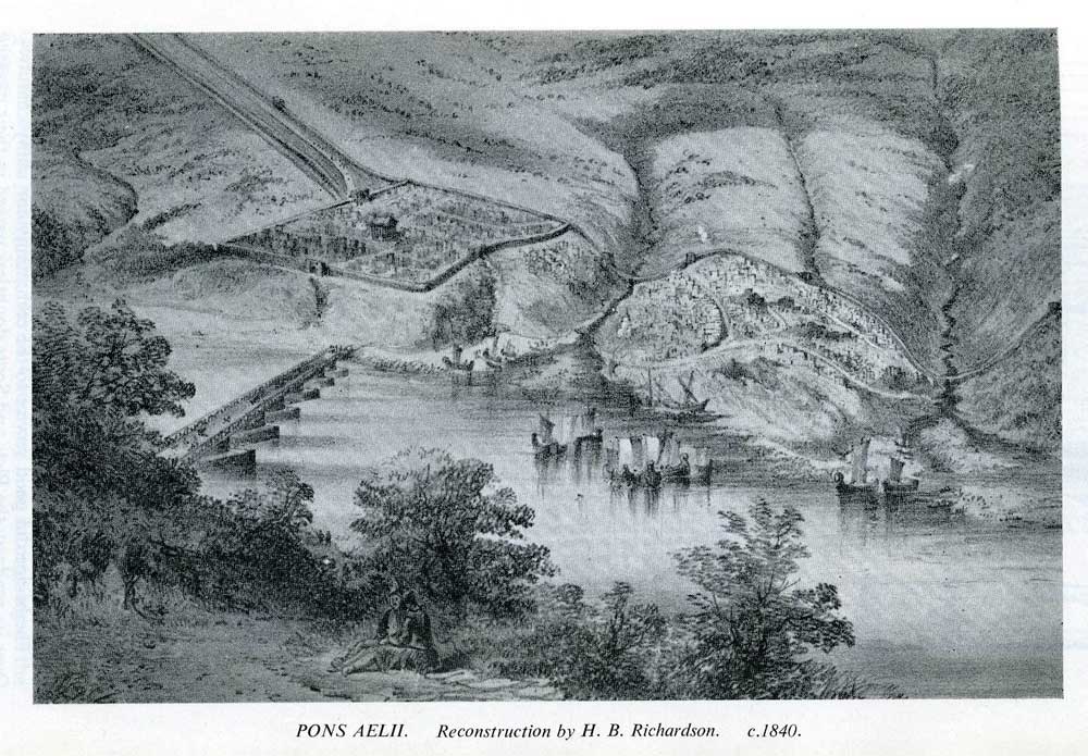
Newcastle developed around a Roman settlement, Pons Aelius (Monkchester), with an estimated population of 2,000. Newcastle took its current name when, in 1080, Robert Curthose, William the Conqueror’s son, built the new castle in his father’s honour. The boundaries of the Roman fort marked the land as the best location for settling, looking down the river. The fort was there for protection; roads outside the wall connected with the new bridge and the surrounding green spaces. The landscape seemed open, with hills and green space in abundance.
紐卡素(Newcastle)的發展圍繞著一個羅馬定居點 Pons Aelius(Monkchester),當時估計有 2,000 人口。在 1080 年,威廉征服者的兒子羅伯特·庫爾索(Robert Curthose)為了紀念其父親而建造了新城堡,紐卡素(另譯作「新堡」)因此獲得了現在的名稱。羅馬堡壘的邊界標誌著這片土地是最佳的定居地,俯瞰著河流。堡壘的建成旨在提供防護;城牆外的道路與新橋以及周圍的綠地相連。這裡的景觀開闊,周圍環繞著山丘和豐裕的綠地供應。
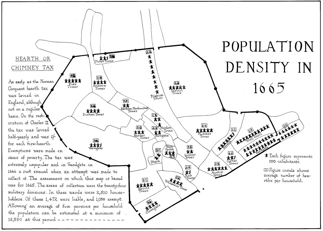
The population on the map is estimated at 12,550. The information here is shown through a tax called the hearth and chimney tax. This was so unpopular that riots broke out in areas of Newcastle when it was being collected in 1666. Newcastle is defined here by the Town Wall built in the 16th and 17th centuries to defend the city from invaders; it had 6 gates for access in and out of the city. As the wall cut through the gardens of the Blackfriars, there was a smaller entrance so the Friars could look after the people of Newcastle with herbal medicines and foods.
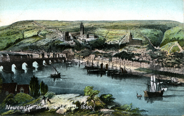
The postcard shows the beginning of how cities are formed along the river Tyne. The bridge made travelling easier; transportation by ship greatly helped trade development. Most merchant activities and lifestyles are based along the Tyne quayside. A little inland, you can see the Castle, churches, and the town hall building. These are more likely for administration, culture, and religion. We can see a large supply of green open space still surrounding the city.
地圖上的人口估計為 12,550。這裡的資訊通過一種名為“爐火和煙囪稅”的稅收顯示出來。這種稅收非常不受歡迎,以至於在 1666 年徵收時,紐卡素發生了騷亂。這裡的紐卡素由 16 世紀和 17 世紀建造的城牆界定,旨在保護城市免受侵略者的攻擊;城牆有 6 個門可進出城市。由於城牆切過黑修士的花園,因此設有一個較小的入口,以便修士可以用草藥和食品照顧紐卡素的居民。
這幅明信片展示了城市是如何沿着泰恩河而形成。橋樑使運行變得更容易;船運亦都大大促進了貿易發展。大多數商業活動和生活方式都集中在泰恩河的碼頭旁。
稍微內陸處,你可以看到城堡、教堂和市政廳建築。這些建築更可能與行政、文化和宗教有關。我們可以看到城市周圍還有大量的綠地。

In just around 60 years, the population in the city has doubled from the 1723 map by James Corbridge, with the population now estimated at 24,000. In this map, we see detailed views of 26 public buildings, showing the development of the city in wealth and longer-term planning. Inside the town wall, more division over the use of land can be seen, making the city itself feel alive.
Outside the city walls, more land is required to support the city. Extensions of livelihood surrounding the city are forming, such as farming along the quayside south of the city. On the east side, more housing is built, and more farmland is created, along with churches and hospitals. Personally, I am excited to see Keelmans’ Hospital, Shieldfield, and St Ann’s Church on this very early map of Newcastle. I was living in Keelmans’ Hospital (now one of the listed buildings) when I arrived in Newcastle for the first time in 2005; now living in Shieldfield where I settled, my kids are growing up healthily and happily. St Ann’s Church is one of our neighbourhood churches.
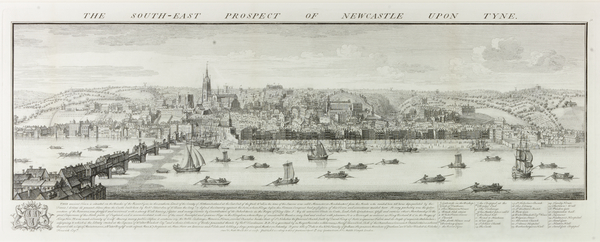
On the etching of Newcastle published in 1745, the population appears as 29,000. You can see the rise of Newcastle, with busy river activities all around the Medieval Bridge, which was the closest bridge across the Tyne. The green spaces are easily seen over the hills, presenting a well-balanced and beautiful land.
在短短 60 年的時間裡,城市人口從 1723 年的詹姆斯·科爾布里奇(James Corbridge)地圖上的數字翻了一番,現在估計為 24,000。
在這張地圖上,我們可以看到 26 個公共建築的詳細景觀,顯示了城市在財富和長期規劃方面的發展。在市城牆內,可以看到土地使用的更多劃分,使城市本身感覺更具活力。
在市城牆外,需要更多土地來支持城市。城市周圍的生計擴展正在形成,例如城市南部碼頭旁的農業。在東側,建設了更多住房和農田,以及教堂和醫院。
我個人很高興看到這張早期的紐卡素地圖上標注着的基爾曼醫院(Keelmans’ Hospital)、希爾德菲爾德區 (Shieldfield) 和聖安教堂(St Ann’s Church)。2005 年我第一次來到紐卡素時曾住在基爾曼醫院(現在是列入受保護建築名單的建築之一);現在我住在我定居的希爾德菲爾德區(Shieldfield),我的孩子們在這裡健康快樂成長。聖安教堂在我們的鄰舍。
在 1745 年出版的紐卡素銅版畫中,人口顯示為 29,000。你可以看到紐卡素的興起,泰恩河上繁忙的河流活動圍繞著中世紀橋樑,這是泰恩河上最近的橋樑。綠地在山丘上顯而易見,展現了平衡和美麗的土地。
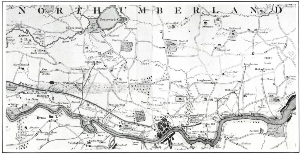
The population at this point is estimated at 32,000. This is a much bigger scale map of the region; the city appears tiny at this scale but still dense with buildings. We can also see Gateshead developing into another main area along the river Tyne, forming further housing and churches.
This map shows there is the possibility for expanding the use of land away from agriculture and towards industry and housing.
You can see moors spread across different areas of the region. Moors here would be large areas of land with low-growing vegetation used for livestock, growing, and fresh air.
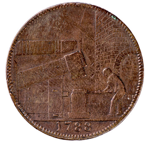
The trade token shows the growth of trade and industry as a mass of agricultural workers moved into factories during the industrial revolution. Not enough royal mint (small coins) were being made to pay staff and trade with, so businesses began to make their own.
Represented here by John Wilkinson, an iron maker, this copper token was valued at a penny when first made and decreased to a halfpenny subsequently. This practice was banned by the Government in 1831.
此時的人口估計為 32,000。這是一張更大規模的區域地圖;在這個比例下,城市顯得微小,但仍然密集建築。我們還可以看到蓋茨黑德(Gateshead)沿泰恩河發展成為另一個主要地區,形成了更多的住房和教堂。查看這張地圖顯示,土地的使用有可能從農業擴展到工業和住房。
你可以看到不同區域散佈著荒野地。這裡的地皮是大面積的低矮植被地,用於牲畜放牧、耕作和新鮮空氣。
貿易代幣顯示了貿易和工業的增長,因為大量農業工人轉入工廠。皇家鑄幣(小硬幣)的生產不足以支付工資和貿易,因此企業開始自製代幣。由鐵匠約翰·威爾金森(John Wilkinson)所製作的這個代幣,最初的價值為一便士,其後降至半便士。這一做法於 1831 年被政府禁止。

Population – 36,000
This map from 1808 shows the names of two towns developing next to each other, connected by the only bridge. Both cities are growing fast, as shown on this map, with the density of housing lining the area and continuing to spread to the River Ouse and Walker, with small villages developing along the Tyne.
The town is so packed that I don’t see many green spaces in-between areas, with the spread of urbanisation. Where are our much desired green spaces and clean air?
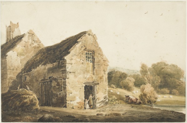
The cottage painting based just outside the city shows that rural life still has its place at this moment in time. The cottage is surrounded by green spaces, giving a calm feeling, which is now understood as a basic need for every lifestyle.
人口 – 36,000
這張1808年的地圖顯示了兩個相鄰發展的城鎮的名稱,它們由唯一的橋樑相連。兩座城市都在迅速增長,如這張地圖所示,住房的密度沿著區域分佈,並繼續擴展到奧斯河(River Ouse)、沃克(Walker),以及泰恩河沿岸發展的小村莊。
城市開始擁擠,看不到很多綠地,隨著城市化的擴展。我們現在渴望的綠地和清新空氣在哪裡?
這幅位於城市邊緣的鄉村小屋畫作顯示,當時的鄉村生活仍有其地位。小屋被綠地環繞,帶來平靜的感覺,現被理解為每種生活方式的基本需求。
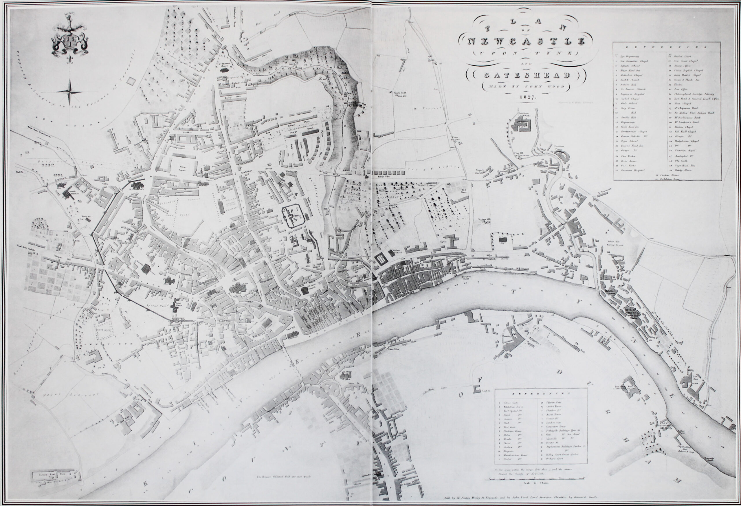
Population estimated at 76,000. Wow, the town wall is disappearing!
Nearly a decade earlier, the quayside area of the town wall was demolished as it was creating issues for merchants and traders. With no worry of invasion, the walls were left to deteriorate. As this map shows us, Newcastle is a fast-growing city, thanks to the plans and people’s hard work.
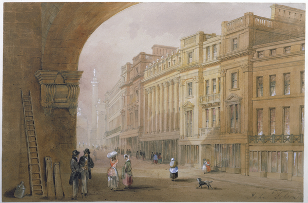
The painting shows the plans for a developing town, with Grey Street as the centrepiece, led by Richard Grainger. The painting may have been made before the buildings were actually finished, as a demonstration of how fine they would look. The grand Neo-Classical style stone buildings became the commercial heart of Newcastle, replacing the previous centre on the quayside.
人口估計為 76,000。哇,市城牆正在消失!
大約十年前,市城牆的碼頭區域被拆除,因為它對商人和貿易商造成了問題。由於沒有入侵的擔憂,城牆未曾計劃過要修補。 根據這張地圖, 紐卡素向我們展示了她是一個快速增長的城市, 多得城市的規劃和市民辛勤工作的成果。
畫作展示了發展中的城市規劃,格雷街(Grey Street)是中心,由理查德·格蘭傑(Richard Grainger)主導。這幅畫可能是在建築實際完成之前製作的,作為其效果的示範。宏偉的新古典風格石砌建築成為紐卡素的商業中心,取代了先前沿泰恩河碼頭的中心。
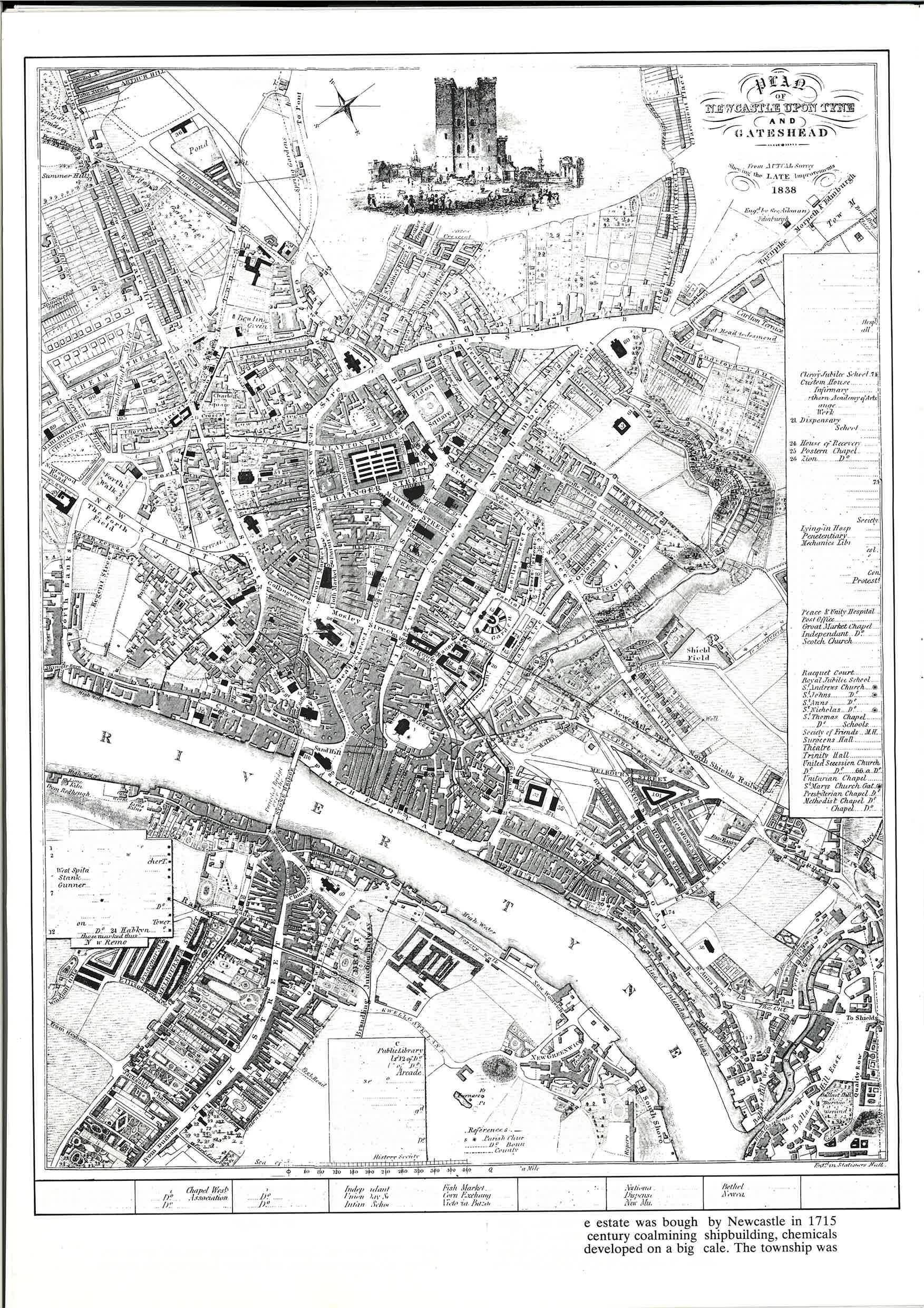
Population said to be at 93,000.
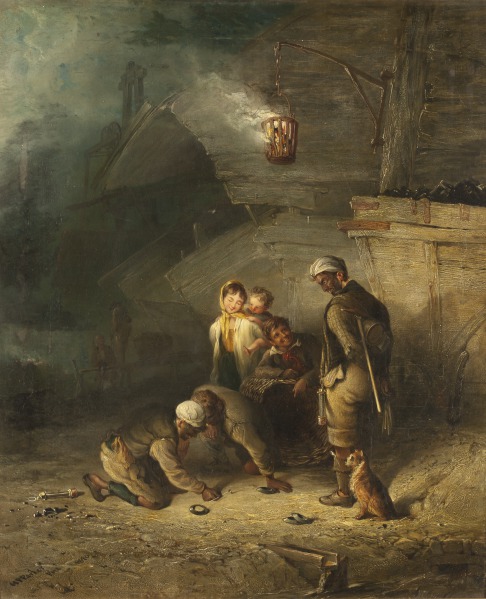
The 1838 map is not simple anymore. Over the past century, shipbuilding, chemical, and iron works had developed on a large scale, especially in the Walker area. Where could people go for some fun and a walk in the fresh air? The people had a very hard lifestyle, shown here in the 1840 painting with miners living and socialising around their work. They can be seen having some fun during a rest time and finding a small space to play and converse, but they are still covered in coal dust; it would have been a bit fairer if this had been in a nicer and greener space.
人口達到 93,000。
1838年的地圖不再簡單。過去一個世紀,造船、化工和鐵工業在沃克 (Walker) 地區大規模發展。人們可以去哪裏尋找樂趣和新鲜空氣?人們的生活方式非常艱難,1840年畫作中顯示出鄺工們只可以在工作環境周圍生活和社交, 他們會在休息時找小空間玩耍和交流,但仍然滿是煤塵;如果有綠地和比較舒適空間供應市民, 會比較公平。
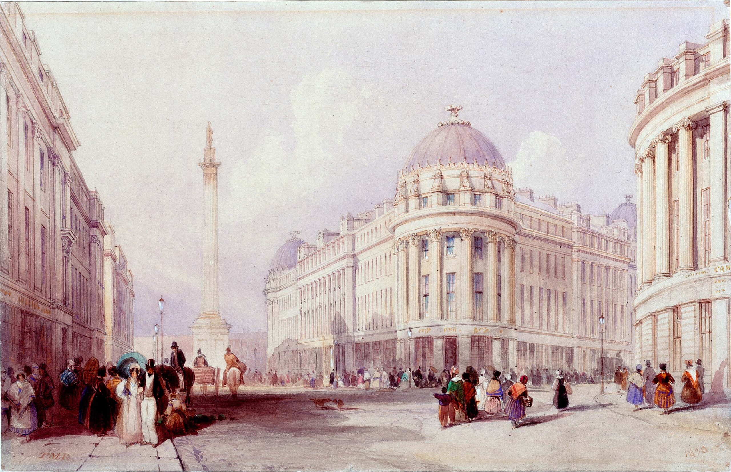
The streets of Newcastle city centre are very alive, indoors and outdoors, with the population around the time estimated at 93,000 in 1838, rising to 110,000 by 1850.
I chose this particular painting as it was painted from the same angle as the painting I first introduced you to, Grainger Street by Louis H. Grimshaw (1902), which depicts an evening scene.
This painting from 1838, depicting daytime, shows the architecture and planning of streets were well organised, with those big buildings making people and even large animals look so small in contrast. Developed by Richard Grainger, these grand stone Neo-Classical buildings created a new commercial town centre, which was previously situated on the Newcastle quayside. There is no nature in the street; could no one see the value of this?
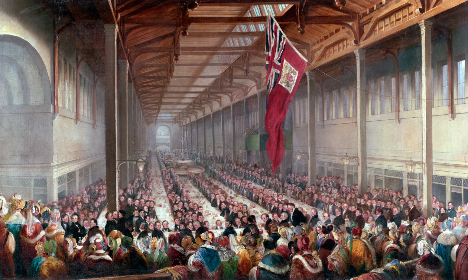
The Grainger Market, a space to buy and sell meat and vegetables, was also part of his plan. The painting here is about the opening event of the Grainger Market in 1834; it feels like a big meeting in parliament, and there are only men; the women were only allowed to look on from the side. This is not like the market I go to nearly every day now, but the interior and main setting are the same, well used and maintained after all these years.
紐卡素市中心的街道非常活躍,無論是室內還是室外,1834 年的人口估計約為 93,000,到 1850 年上升至 110,000。
我選擇了這幅畫,因為它與我最初介紹給你由路易斯·H·格里姆肖(Louis H. Grimshaw)創作的那幅描繪黃昏後的「格蘭𠎀街」畫作繪畫角度相同。這幅 1838 年的畫作展示了早上街道的建築和規劃,顯示了建築物使人和大型動物在對比中顯得如此渺小。由理查德·格蘭傑(Richard Grainger)開發的這些宏偉的新古典風格石砌建築創造了一個新的商業城鎮中心,取代了先前位於紐卡素碼頭的中心。街道上沒有自然景觀;難道沒有人看到這一點的價值嗎?
格蘭傑市場(Grainger Market)是一個購買和出售肉類和蔬菜的空間,也是他的計劃的一部分。這幅畫描繪了 1834 年格蘭傑市場的開幕事件,感覺像是一個大型議會會議,只有男性;女性只被允許在旁邊觀望。這與我現在幾乎每天去的市場不同,但內部和主要設置保持不變,多年來得到良好的使用和維護。
By 1850, official counts of the population reached 110,000.
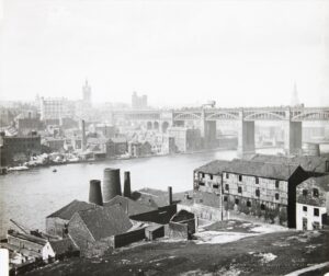
The need for better transportation connections between Newcastle, Gateshead, and wider towns and cities, as well as trades like the delivery of coal, became important. The High-Level Bridge was designed by Robert Stephenson to accommodate trains and pedestrians while also taking into account the need for ships to pass under it; hence its name.
到 1850 年,官方人口統計達到 110,000。
對於紐卡素、蓋茨黑德以及更廣泛的城鎮和城市之間的交通連接需求,加上像煤炭運送這樣的貿易變得重要。高層橋(High-Level Bridge)由羅伯特·斯蒂芬森(Robert Stephenson)設計,以適應火車和行人,同時考慮到船隻通過的需求,因此得名。
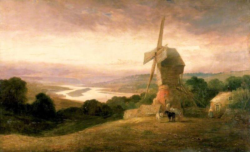
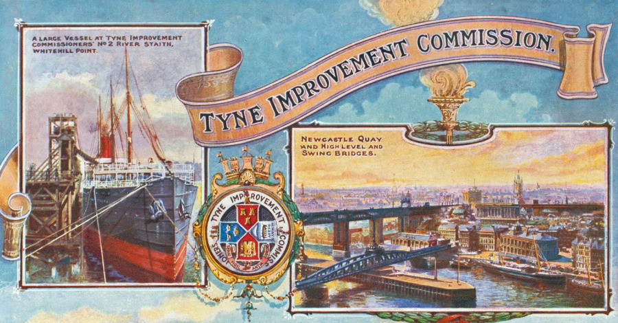
By the 1860s, the Tyne was Britain’s second most important river. It was the focal point of the Golden Age of Coal, Iron, and Steam – coal mining, railway engineering, and shipbuilding, as part of the Industrial Revolution, created a need for improvements on the River. The Tyne Improvement Commission had been created and was ready for action, and in 1862 major works on the river began.
This painting shows us rural Newcastle in 1818. As you look up the Tyne, you might not realise there’s an island called ‘Kings Meadow’ sitting right in the middle.. Kings Meadow was a flat island in the river between Elswick on the North Bank and Dunston on the South. A smaller island called Little Annie can be seen nearby. The islands were removed by dredging between 1862 and 1887 by the Tyne Improvement Commission to make it easier for river traffic to pass.
到 1860 年代,泰恩河成為英國第二重要的河流。它是煤炭、鐵和蒸汽的黃金時代的焦點——煤礦開採、鐵路工程和造船,作為工業革命的一部分,促使了對河流改進的需求。泰恩河改進委員會已經成立並準備啟動,1862 年開始了對河流的重大工程。這幅畫展示了 1818 年的鄉村紐卡素。你可能無法意識到當你在向上看泰恩河的時候,有片島嶼在中間。
國王草地(Kings Meadow)是位於艾爾斯威克(Elswick)北岸和鄧斯頓(Dunston)南岸之間的河流中的一個平坦島嶼。附近還可以看到一個小島叫做“小安妮”(Little Annie)。這些島嶼在 1862 到 1887 年間由泰恩河改進委員會通過挖泥清除,以便河流交通更為通暢。
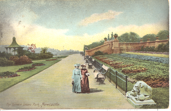
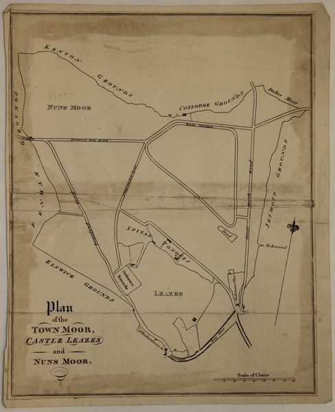
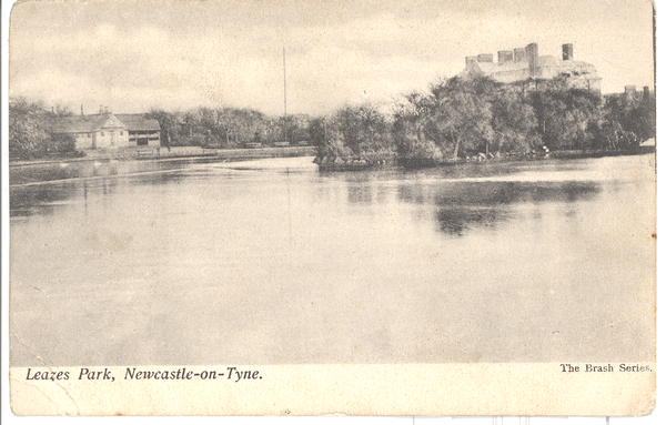
After hard work in different industrial environments, it became clear that the general health of workers and residents would decline. This did not seem to be good for the long-term prosperity of business owners if their workers were unwell and not performing. Demand for green spaces for recreation, and in turn health, was a concern for poorer people, especially the working classes.
The Leazes Campaign was an example of people’s need for green spaces, fresh air, and recreation. The campaign began in 1857 with 3,000 working men petitioning Newcastle Council for ‘ready access to some open ground for the purpose of health and recreation’. A year later, a special committee was set up. They would not be successful until 1873 when a park was opened in the area of Leazes on the Town Moor. This was the first public park to be opened on Tyneside.
During this period, in 1870, the Town Moor Improvement Plan was established. The Act of Parliament 1774 protected the land from being built on, and as part of the desired changes, the 1870 Town Moor Improvement Act was established, designating two areas to become areas of recreation. This was updated in 1988. As part of this, Bull Park was also proposed as a space for recreation, later establishing its name as Exhibition Park after the Royal Mining Engineering Jubilee Exhibition in 1887.
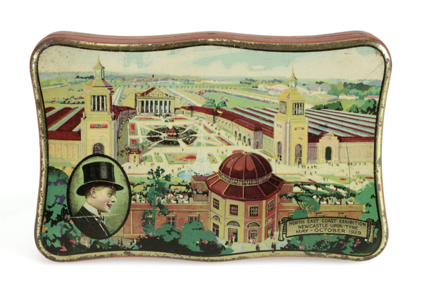
Further establishing itself as a place for celebrating local achievements with the North East Coast Exhibition, this park was developed extensively for this purpose, as seen in the biscuit tin illustration. The layout and features of the park is very different, but only one building remains—the Palace of the Arts, which housed a museum of science and engineering until 1983.
在不同的工業環境中辛勤工作後,工人和居民的整體健康狀況逐漸惡化。這對於商業主的長期繁榮似乎不利,如果工人健康不佳且表現不好。
對綠地的需求,尤其是對貧困和工人階級的健康問題,成為了一個關注點。
利茲運動(Leazes Campaign)是一個關於人們對綠地、新鮮空氣和休閒需求的例子。這場運動始於 1857 年,3,000 名工人向紐卡素市議會請願,要求「方便地進入一些開放空間以促進健康和休閒」。一年後,一個特別委員會被成立。他們直到 1873 年才成功,在利茲區的城市荒地上開設了一個公園。這是泰恩河沿岸開設的第一個公共公園。
在這段時間,1870 年,建立了城市荒地改進計劃。1774 年的國會法案保護了這塊土地不被建設,作為所需變更的一部分,1870 年的城市荒地改進法案確立了兩個區域成為休閒區。這在 1988 年有繼續得到更新。作為其中的一部分,還提議將布爾公園(Bull Park)作為休閒空間,後來在 1887 年皇家礦業工程紀念展覽會後更名為展覽公園(Exhibition Park)。
進一步建立自己作為慶祝當地成就的場所,與東北海岸展覽(North East Coast Exhibition)一起,這個公園進行了廣泛的發展,如餅乾罐插圖所示。公園的佈局和設施已經改變,但只有一座建築物——藝術宮(Palace of the Arts),在 1983 年之前曾擁有科學和工程博物館。
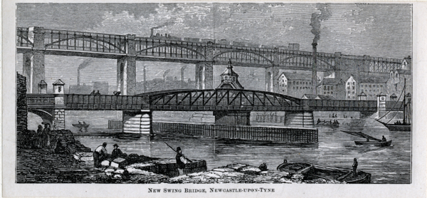
I love the clever design of the swing bridge. It looks pretty , multifunctional, and able to support lots of transport across and over the river. The previous bridge on the same site was demolished in 1868 to enable larger ships to move upstream to William Armstrong’s works. The hydraulic Swing Bridge was designed and paid for by Armstrong. At the time of construction, it was the largest swing bridge ever built.
Armstrong developed the hydraulic generator, leading to the hydraulic power used to move the bridge. This was hugely successful, with the busiest year of operation in 1924 when the bridge was rotated 6,000 times.
我好鍾意這座旋轉橋的巧妙設計。它看起來又靚又實用,能支持大量交通穿越河流。同一地點上的前一座橋樑於 1868 年拆除,以便更大的船隻能向上游移動到威廉·阿姆斯特朗(William Armstrong)的工廠。這座液壓平旋橋由阿姆斯特朗設計和資助。在建設時,它是世界上最大的旋轉橋。阿姆斯特朗開發了液壓發電機,推動了移動橋樑所需的液壓力量。這非常成功,直到1924 年的運營高峰年,橋樑已經旋轉了 6,000 次。
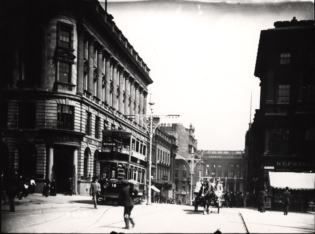
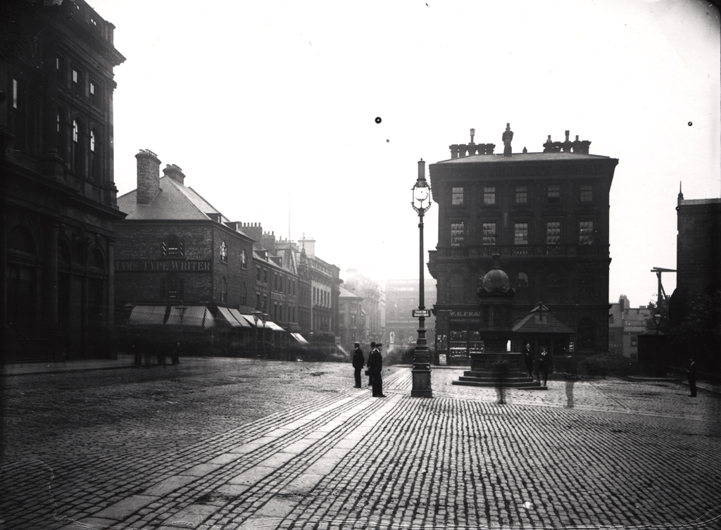
Mosley Street in Newcastle was the first in the world to have electric lighting. In my chosen painting of Grainger Street shown previously, you can see the introduction of electric street lighting, with some gas lights still present. The development of the electric lightbulb had a huge impact on lifestyles; it helped prevent anti-social behaviour after dark and allowed for longer working hours. In 1879, Edison’s lightbulbs became available to buy; then, in 1883, after copyright issues with Joseph Swan, both parties agreed to collaborate, opening the Edison and Swan Electric Lighting Company.
紐卡素的莫斯利街(Mosley Street)是世界上第一條有電燈的街道。你可以從我之前選擇的油畫見到,街道的影像顯示了電燈的引入,同時仍有一些煤氣燈存在。電燈泡的發展對生活方式產生了巨大影響;它有助於防止夜間的反社會行為,並允許更長的工作時間。1879 年,愛迪生的燈泡開始出售;然後在 1883 年,經過與約瑟夫·斯萬(Joseph Swan)的版權問題後,雙方同意合作,成立了愛迪生與斯萬電燈公司(Edison and Swan Electric Lighting Company)。
Population at 615,000 by the 1900s.
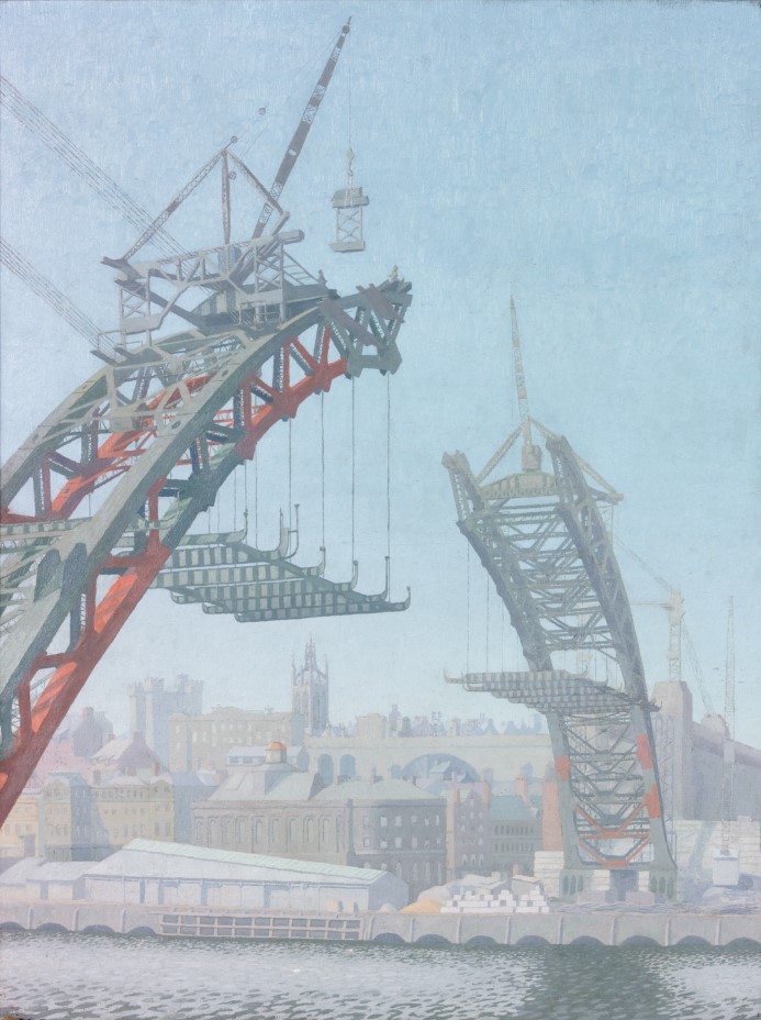
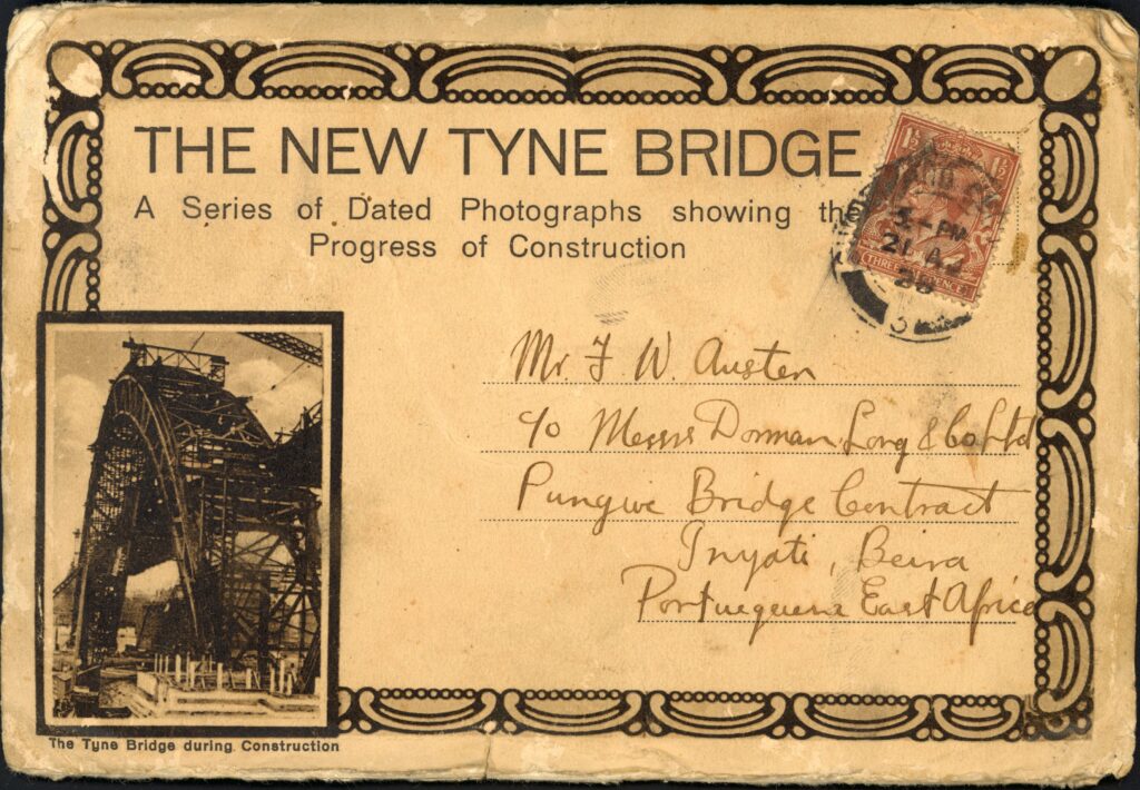
The Tyne Bridge was opened in 1928, built for the new age of motorised traffic. At the time of building, it was the world’s longest bridge span. This connects cultures from the other side of the world. What impresses me also is that the first woman allowed into the Institute of Civil Engineering, Dorothy Buchanan, was a significant part of the design team.
Under the bridge, there is a large group of kittiwake birds. What has happened for them to need buildings to nest on and not nature?
到 1900 年代,人口達到 615,000。
泰恩橋(Tyne Bridge)於 1928 年開放,為新時代的機動交通而建。在建設時,它是世界上最長的橋樑跨度。這連接了來自世界另一端的文化。令我印象深刻的是,第一位被允許進入土木工程學會的女性,多蘿西·布坎南(Dorothy Buchanan),是設計團隊的重要成員。
橋下住有一群燕鷗鳥(kittiwake)。佢哋點解需要在建築物上築巢,而唔係喺自然界中呢?
Contemporary Times
現代的紐卡素
2011 population: 280,100
2021 population: over 300,000
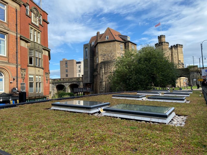
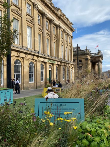
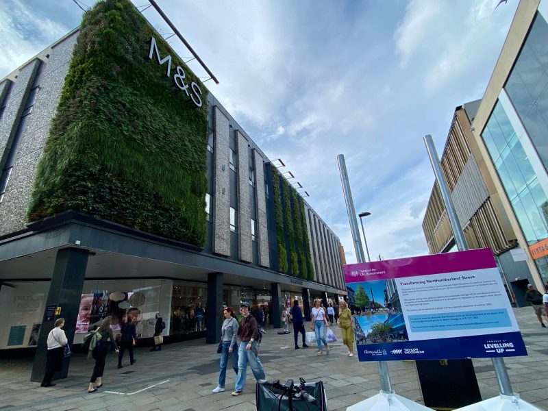
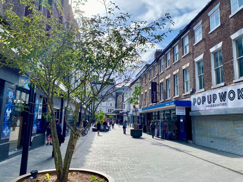
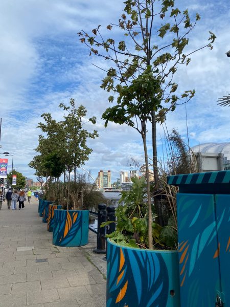
The population in and around cities has grown so much, and we are now living in much higher-density urban environments. Green spaces are essential for cleaner and fresher living. In Newcastle, private owners have added living roofs and walls to their properties, and the Council has created a few small green spaces within the city. Planters have been placed on streets, though this has sometimes come at the cost of some older trees being removed.
I hope we can welcome more green spaces and celebrate our heritage by preserving the older buildings that help make the city what it is today!
2011年人口:280,100
2021年人口:超過300,000
城市及周邊地區的人口增長了很多,我們現在居住在密度更高的城市環境中。綠色空間對於更清潔和清新的生活環境至關重要。在紐卡素,私人業主會在他們的物業上加建綠化屋頂和牆壁,市議會也在市內樹立了幾個小型綠化空間,並在街道上放置了花槽,但這有時是以移除一些較老的樹木為代價。
我希望我們能夠迎接更多的綠色空間,並通過保存那些幫助塑造城市特色的舊建築來慶祝我們的文化遺產!
